SYSTEM ACTIVE // [ HOME ] // [ GP CALC ] // [ J-POLE CALC ] // [ SERIAL LOG ] // [ FIRMWARE FLASHER ] // [ IT ] / [ EN ]
--:--:--
TRACKING OPERATIONS // RADIOSONDES

SONDE NOOB :)

Tracking and recovery of meteorological radiosondes.
Two sondes are launched every day from Pratica di Mare, at 13:00 and 01:00. This site monitors the launches in real time and stores the sonde telemetry in a database.

Amateur radiosonde hunting RU0170.

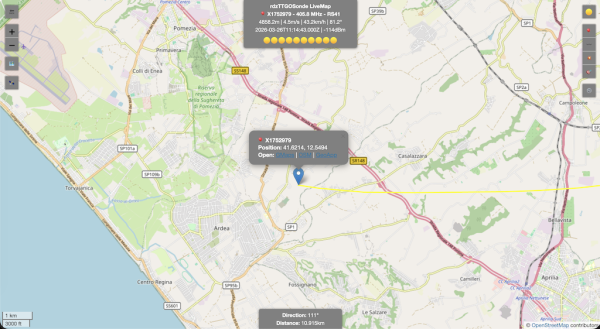
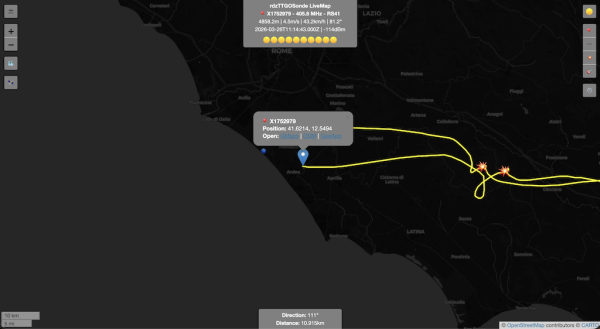
LIVE TELEMETRY // V4730981 MAP ALT LAST 5 TRACKS TOP 5 HISTORY RAW HUB 46 secs ago
Loading history...
ALTITUDE
11,388m
HORIZONTAL SPEED
18.4km/h
VERTICAL SPEED
9.1m/s
DISTANCE
39.68km
FREQUENCY
405.800 MHz
COURSE
90°
SATELLITES
11 SATS
BATTERY
2.5 V
LATITUDE
41.50451
LONGITUDE
12.85835
LAUNCH SITE
PraticaDiMare
MODEL
RS41-SG
// Tracked sondes
145
TOTAL UNITS
// Max altitude
36.1
ALTITUDE KM
// Max distance
187.4
KM FROM LAUNCH
OPERATION INFO
What is a radiosonde

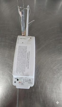
A radiosonde is a meteorological instrument lifted by a weather balloon, transmitting temperature, humidity, pressure and GPS position in real time.

They are launched twice a day by weather stations across Europe.

How we recover them

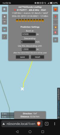
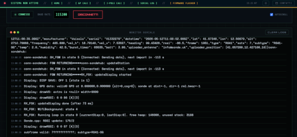
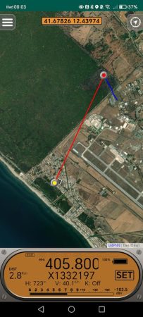
We use tools such as rdzsonde to follow the trajectory in real time over radio frequency (400–406 MHz).

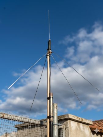
With SDR receivers and directional antennas we reach the landing point.

Equipment and software
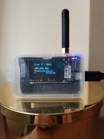
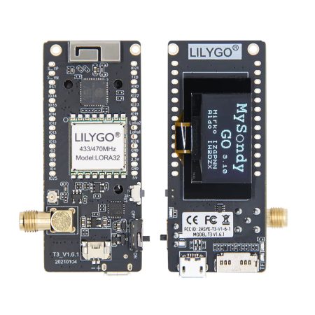
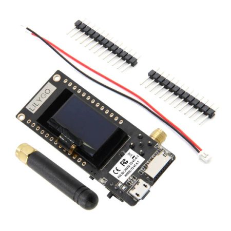
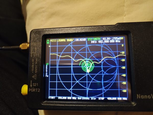
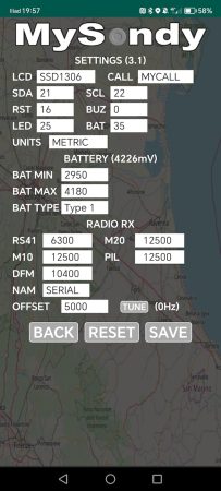
TTGO LORA32 v2.1_1.6 Antenna LilyGo Lora32 - default rdzsonde.org/ MysondyGo/ Sondehub.org
Operating area

We operate mainly in Central Italy/Lazio, following launches from Pratica di Mare.

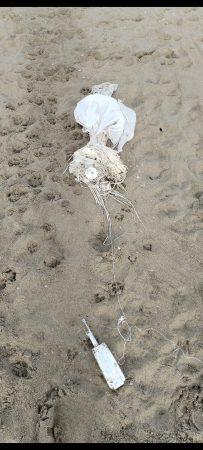
Each recovery is documented with photos, GPS coordinates and telemetry data.
LAUNCH SCHEDULE
Launch site WMO code UTC times CET times Frequency (MHz) Model Notes
Pratica di Mare 16245 00Z / 12Z 01:00 / 13:00 401.0 - 405.8 Vaisala RS41/RS41-SG Often stable frequency
Cuneo-Levaldigi 16113 00Z / 12Z 01:00 / 13:00 402.8–405 Vaisala RS41-SG Automated sounding
Milano-Linate 16080 00Z / 12Z 01:00 / 13:00 401–405 Vaisala RS41-SG Historic northern site
Udine-Rivolto 16045 00Z / 12Z 01:00 / 13:00 400–406 Vaisala RS41-SG Italian Air Force
Cameri 16044 00Z / 12Z 01:00 / 13:00 400–406 Vaisala RS41-SG Alternate to Linate
San Pietro Capofiume (BO) 16144 00Z / 12Z 01:00 / 13:00 401–406 Vaisala RS41-SG Main weather center
Lecce Galatina / Brindisi 16320 00Z / 12Z 01:00 / 13:00 400–406 Vaisala RS41-SG Southern Italy
Trapani Birgi 16429 00Z / 12Z 01:00 / 13:00 400–406 Vaisala RS41-SG Sicily
Cagliari Decimomannu 16560 00Z / 12Z 01:00 / 13:00 400–406 Vaisala RS41-SG Sardinia
Cesana Pariol (storico) N/A 00Z / 12Z 01:00 / 13:00 400–406 RS92 → RS41 Not always active
USEFUL LINKS
rdzTTGOsonde
Meteorological sonde tracking
Software for decoding RS41, RS92, DFM06/09/17, M10/M20 and MP3H radiosonde signals based on a TTGO LoRa ESP32 board.
SondeHub
Global balloon and radiosonde tracking
Open project that shows radiosonde and experimental balloon trajectories on a global map, with telemetry aggregated from a receiver network.
MySondyGo
Portable radiosonde tracking
MySondy GO is a FREE project that lets you receive, decode and visualize signals from meteorological radiosondes (e.g. RS41) using a TTGO LoRa32 433 MHz (ESP32) board and a dedicated mobile app.
Aprs.fi
Online APRS data
Online platform mostly used by radio amateurs to visualize real-time APRS data on a map.
radiosondy.info
Central Europe radiosonde tracking
Site dedicated to radiosonde monitoring with a real-time map, launch list, flight data and useful recovery information.
Meteoam Radiosondaggi
Official Italian Air Force radiosonde soundings
Sezione del Servizio Meteorologico dell’Aeronautica Militare con informazioni su rete di stazioni di radiosondaggio e dati verticali dell’atmosfera per l’Italia.[web:14]
Climantartide Radiosondaggi
Scientific radiosoundings (Antarctica)
Sito di progetto scientifico che descrive il sistema di radiosondaggio in Antartide e mette a disposizione profili verticali e documentazione tecnica sulle radiosonde usate.[web:15]
wettersonde.net
Global radiosonde tracking (community)
Community site that collects and displays real-time radiosonde launches from several countries, with position, trajectory and main data.